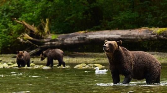
I continued to work with the code from the previous post. I made a list of beautiful places in Canada and learned many new things from it, especially about the Kermode bear.
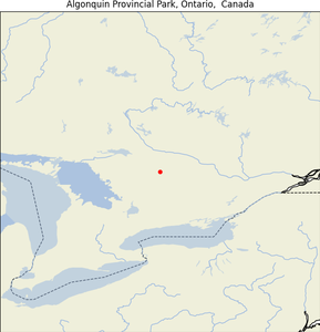
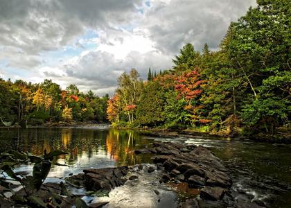
Algonquin Provincial Park, Ontario
| Map |
Img |
 |
 |
- Geographical Location: Ontario, Canada; between Georgian Bay and the Ottawa River.
- Establishment Date: Established in 1893.
- Purpose: Algonquin Provincial Park serves as a provincial park to protect the environment and provide recreational activities.
- Special Features:
- Contains over 2,400 lakes and 1,200 kilometers of streams and rivers.
- Named a National Historic Site in 1992 for its influence in park management and visitor interpretation programs.
- Home to diverse plant and animal species due to its unique location at the transition between northern coniferous forest and southern deciduous forest.
- Summary: Algonquin Provincial Park is not only the oldest provincial park in Canada but also one of the most popular, due to its extensive size, variety of lakes and rivers, and its location near major urban centers like Toronto and Ottawa.
Note from son:
Algonquian peoples are group of North American Native.
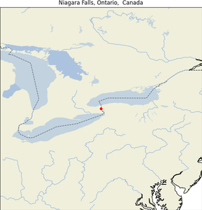
Niagara Falls, Ontario ✅
| Map |
Img |
 |
 |
- Geographical Location: Border of Ontario, Canada, and New York, USA.
- Significant Date: Long-standing as a major natural landmark.
- Purpose: Serves as a major source of hydroelectric power and a monumental tourist attraction.
- Special Features:
- Consists of three different waterfalls: Horseshoe Falls, the American Falls, and the Bridal Veil Falls.
- Has the highest flow rate of any waterfall in North America.
- Summary: Niagara Falls is not only a testament to natural beauty and power but also a pivotal industrial and cultural landmark, attracting millions of visitors worldwide and playing a critical role in the regional economy.
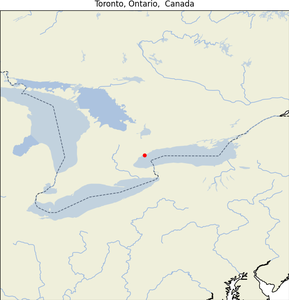
Toronto, Ontario ✅
| Map |
Img |
 |
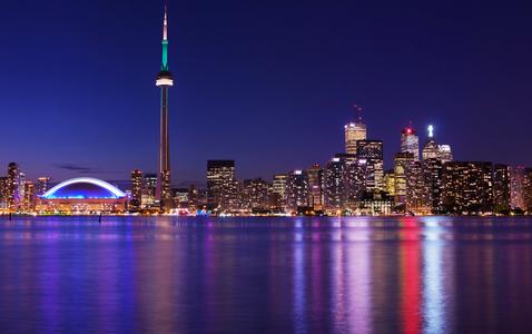 |
- Geographical Location: Southeastern Ontario, Canada.
- Establishment Date: Incorporated as a city in 1834.
- Purpose: Serves as the financial and cultural capital of Canada.
- Special Features:
- Home to the CN Tower, one of the world’s tallest freestanding structures.
- Hosts numerous international events, including the Toronto International Film Festival (TIFF).
- Summary: Toronto is a dynamic, multicultural metropolis known for its high standard of living, vibrant arts scene, and as a global center of business, finance, and culture.
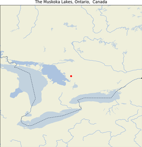
The Muskoka Lakes, Ontario
| Map |
Img |
 |
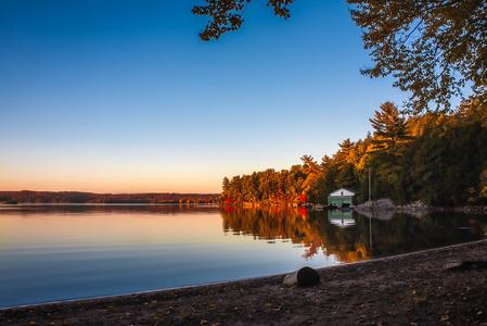 |
- Geographical Location: Central Ontario, Canada.
- Purpose: Known for being a major summer cottage destination for residents of Ontario.
- Special Features:
- Comprised of numerous lakes, including Lake Muskoka, Lake Rosseau, and Lake Joseph.
- Offers a wide array of outdoor recreational activities, such as boating, golfing, and luxury resorts.
- Summary: The Muskoka Lakes region, often referred to simply as Muskoka, is celebrated for its stunning natural beauty and as a haven for vacationers seeking relaxation and recreational activities in a picturesque setting.
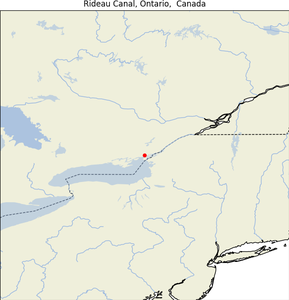
Rideau Canal, Ontario
| Map |
Img |
 |
 |
- Geographical Location: Connects Ottawa, Ontario to Lake Ontario and the Saint Lawrence River at Kingston, Ontario.
- Establishment Date: Opened in 1832.
- Purpose: Initially used for military purposes, now a significant recreational and tourism site.
- Special Features:
- A UNESCO World Heritage Site.
- In winter, it becomes the world’s largest skating rink.
- Summary: The Rideau Canal is celebrated for its historic significance and recreational value, providing a scenic waterway for boating in the summer and skating in the winter, connecting multiple communities along its path.
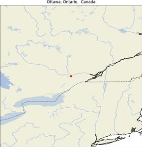
Ottawa, Ontario ✅
| Map |
Img |
 |
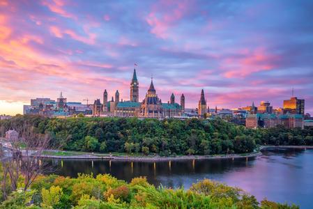 |
- Geographical Location: Capital city of Canada, in southern Ontario.
- Establishment Date: Founded in 1826; designated as the capital in 1857.
- Purpose: To serve as the administrative center of Canada.
- Special Features:
- Home to Parliament Hill, numerous national museums, and cultural institutions.
- Hosts several major international festivals and events.
- Summary: Ottawa stands out for its historical significance and vibrant cultural scene, encapsulated within its role as the political heart of Canada, showcasing a blend of French and English heritages.
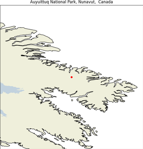
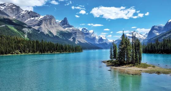
Auyuittuq National Park, Nunavut
| Map |
Img |
 |
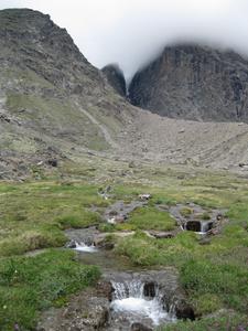 |
- Geographical Location: Baffin Island’s Cumberland Peninsula, Qikiqtaaluk Region, Nunavut, Canada.
- Establishment Date: Originally established in 1972 and became a full national park in 2000.
- Purpose: The park preserves the Arctic wilderness and natural environment of the region.
- Special Features:
- Known for its rugged terrain featuring fjords, glaciers, and ice fields.
- The park’s name, “AuyBaffin Island, Nunavutuittuq,” means “the land that never melts” in Inuktitut, emphasizing its perennially frozen state.
- Summary: Auyuittuq National Park offers a glimpse into the vast, unspoiled Arctic wilderness, embodying the extreme climate and challenging geography that define the northern parts of Canada.
Note from Son:
There are four mountains in the areas:
- Asgard
- Thor
- Fleming
- Sigurd
You can check out video about Nunavut here
I get hooked by the landscape and history of the area. As I read on, I found interesting facts about Eskimos and their house, Igloo. You can watch a video of how to build an ice house, igloo here
An igloo is a fascinating example of natural engineering that uses physics to maintain warmth in extremely cold environments. It employs three main principles: convection, conduction, and radiation. A person inside an igloo radiates body heat, which circulates in the enclosed space through convection, warming the air. However, heat is also gradually lost through conduction, as it transfers from the warmer inside air to the cooler snow walls. The key to an igloo’s insulation lies in the texture of the snow, similar to how otters have dense fur for insulation. The walls of an igloo are thick but still allow some air pockets, trapping warmth. Igloos often have different levels inside, with people staying on the higher levels, as heat naturally rises. Constructing an igloo requires specific conditions, such as using snow from a single storm, and can be done quickly, typically within 30 minutes, to avoid exposure to harsh weather. The word “igloo,” or “iglu,” comes from the Eskimo word for “house,” highlighting its primary function as a shelter against the elements.
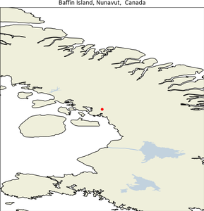
Baffin Island, Nunavut
| Map |
Img |
 |
 |
- Geographical Location: Nunavut, Canada.
- Notable Date: Area settled as of the 2021 Canadian census.
- Purpose: The island serves primarily as a natural habitat with significant cultural history.
- Special Features:
- Largest island in Canada and the fifth-largest in the world.
- Features the city of Iqaluit, the capital of Nunavut, with a low population density emphasizing its vast, open landscapes.
- Summary: Baffin Island is a cornerstone of Canadian geography and culture, known for its expansive arctic tundra and as a central hub for the Inuit culture and community.
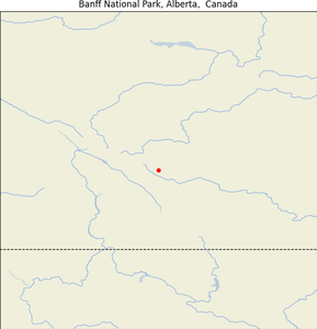
Banff National Park, Alberta
| Map |
Img |
 |
 |
- Geographical Location: Alberta’s Rocky Mountains, Canada.
- Establishment Date: Established in 1885 as Canada’s first national park.
- Purpose: Created to preserve natural beauty and provide a public place for recreation.
- Special Features:
- Encompasses 6,641 square kilometers of mountainous terrain, numerous glaciers and ice fields, dense forest, and alpine landscapes.
- Significant for its history with the Canadian Pacific Railway and early promotional efforts to create a tourist destination.
- Summary: Banff National Park is renowned for its stunning landscape, diverse wildlife, and its status as a major global destination for natural beauty and outdoor activity.
Note from son:
When encountering a grizzly bear (brown bear), it is crucial not to run. Running may trigger the bear’s instinct to chase. Instead, playing dead is often the best strategy—lie flat on your stomach, protect your head and neck with your hands, and spread your legs to make it harder for the bear to flip you over. Grizzly bears are typically more aggressive than black bears, which are less likely to attack. In the case of black bears, standing your ground, making noise, and appearing large can often scare them away. However, if you encounter a polar bear (white bear), it views humans as prey by default, making the situation much more dangerous. If you must defend yourself, aim for the bear’s sensitive areas, particularly the eyes and nose, to maximize your chances of deterring an attack.
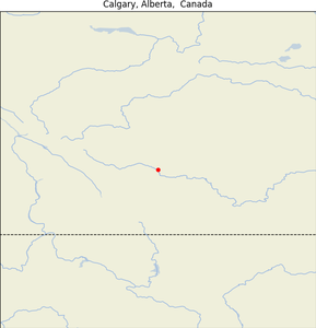
Calgary, Alberta
| Map |
Img |
 |
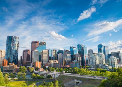 |
- Geographical Location: Alberta, Canada.
- Notable Date: As of 2021, the latest population census.
- Purpose: Calgary functions as a major urban center with diverse economic and cultural roles.
- Special Features:
- Known for its high number of corporate headquarters and a large number of millionaires per capita.
- Hosts the famous Calgary Stampede, an annual rodeo, exhibition, and festival.
- Summary: Calgary is a vibrant city that combines a strong business environment with a rich cultural heritage and numerous recreational opportunities.
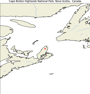
Cape Breton Highlands National Park, Nova Scotia
| Map |
Img |
 |
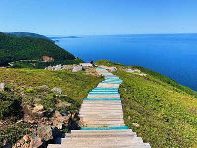 |
- Geographical Location: Northern Cape Breton Island, Nova Scotia, Canada.
- Establishment Date: First national park in the Atlantic provinces of Canada.
- Purpose: To protect the natural scenery and wildlife of the Cape Breton Highlands.
- Special Features:
- Includes the highest point in Nova Scotia, White Hill, at 533.5 meters above sea level.
- Features diverse ecosystems including Acadian and Boreal forests.
- Summary: Cape Breton Highlands National Park is celebrated for its dramatic coastal and mountain landscapes, which offer extensive trails for hiking and a variety of habitats that contribute significantly to the biodiversity of the region.
Note from son:
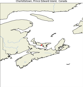
Charlottetown (shaar·luht·town), Prince Edward Island
| Map |
Img |
 |
 |
- Geographical Location: Prince Edward Island, Canada.
- Significant Date: Incorporated as a city in 1855.
- Purpose: Charlottetown acts as the provincial capital and is a key economic and cultural center.
- Special Features:
- Host of the 1864 Charlottetown Conference, which led to the formation of the Canadian Confederation.
- Known as the “Birthplace of Confederation.”
- Summary: Charlottetown is a historic city with a charming blend of old-world charm and modern convenience, making it a pivotal location in Canada’s development and heritage.
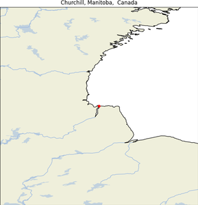
Churchill, Manitoba
| Map |
Img |
 |
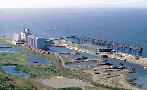 |
- Geographical Location: Located on the west shore of Hudson Bay in Manitoba, Canada
- Established: 1717 (as a Hudson’s Bay Company trading post)
- Purpose: Founded as a fur trading post and later grew into a town
- Special Features: Known for its polar bear sightings, beluga whale watching, and aurora borealis displays; also a significant cultural and historical site for the Indigenous Cree people
- Summary: Churchill is a unique and remote town in Manitoba, known for its stunning natural beauty, diverse wildlife, and cultural attractions. It is often referred to as the “Polar Bear Capital of the World”.
Note from son:
Churchill, Manitoba, is a quiet little place known for polar bears. Folks call it the “Polar Bear Capital of the World,” and if you visit in the fall, you might just see one up close. In the summer, the beluga whales come by, and it’s quite a sight. Even though the weather can be tough, people still come from all over to enjoy the peaceful beauty and maybe catch the northern lights dancing in the sky. It’s a special kind of town.
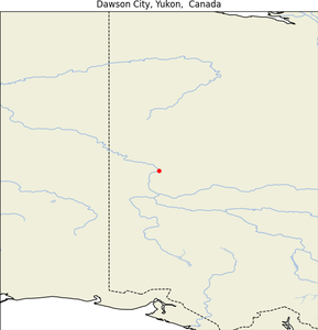
Dawson City, Yukon
| Map |
Img |
 |
 |
- Geographical Location: Yukon, Canada.
- Significant Date: Linked with the Klondike Gold Rush (1896-1899).
- Purpose: Dawson City serves as a living museum to the Klondike Gold Rush.
- Special Features:
- Home to many preserved buildings from the late 19th century and the cultural heritage of the gold rush era.
- The second largest city in Yukon, offering a snapshot of the historical economic activities that shaped northern Canada.
- Summary: Dawson City captures the adventurous spirit of the north with its well-preserved heritage buildings and stories of the gold rush era, offering visitors a glimpse into the past.
Note from son:
- Dawson City, Yukon, is famous for the Klondike Gold Rush. Surrounded by vast, rugged landscapes.
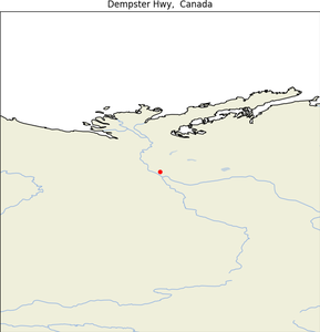
Dempster Highway
| Map |
Img |
 |
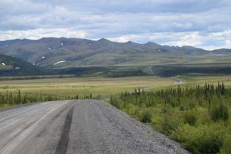 |
- Geographical Location: Connects the Klondike Highway in Yukon to Inuvik, Northwest Territories, Canada.
- Significant Date: Completed in November 2017 to Tuktoyaktuk, creating the first all-weather road to the Arctic Ocean.
- Purpose: Facilitates access to remote northern communities and supports economic development.
- Special Features:
- Crosses several major rivers and stunning landscapes of Canada’s north.
- Named after William Dempster, a North-West Mounted Police officer known for his rescue missions.
- Summary: The Dempster Highway is not only a critical infrastructure project but also a route of stunning natural beauty, offering unprecedented access to the Arctic and showcasing the resilience and determination of Canada in connecting its remote regions.
Drumheller (DRUM-hell-er), Alberta
| Map |
Img |
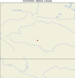 |
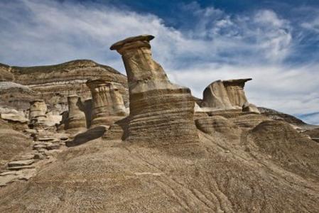 |
- Geographical Location: East-Central Alberta, Canada.
- Establishment Date: Incorporated as a village in 1913, and as a city in 1930.
- Purpose: Known for dinosaur fossil discoveries and paleontological significance.
- Special Features:
- Home to the Royal Tyrrell Museum of Palaeontology, one of the premier dinosaur museums in the world.
- Features unique badland topographies and extensive coal mining history.
- Summary: Drumheller is renowned worldwide for its rich deposits of dinosaur bones, leading to its nickname “Dinosaur Valley.” The city is a prime destination for scientists and tourists alike, drawn by its unique landscape and paleontological treasures.
Note from son:
Drumheller, Alberta, is famous for its rich history of dinosaurs. It’s home to Horseshoe Canyon, a striking landscape shaped by erosion. Most of the dinosaur skeletons found here are well-preserved because, millions of years ago, the area was a coastal plain—flat, with plenty of vegetation to support life. Floods and storms helped bury these creatures, keeping their remains in good condition. Source from BBC
Edmonton, Alberta
| Map |
Img |
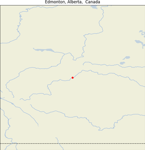 |
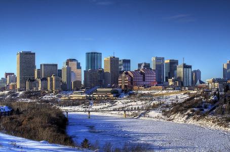 |
- Geographical Location: Capital city of Alberta, Canada, along the North Saskatchewan River.
- Significant Date: Incorporated as a city in 1904.
- Purpose: Edmonton serves as the governmental, cultural, and educational hub of Alberta.
- Special Features:
- Hosts a year-round slate of festivals, earning it the nickname “Canada’s Festival City.”
- Home to the largest mall in North America, West Edmonton Mall, and a vibrant arts scene.
- Summary: Edmonton is a dynamic city with a robust economy based on festivals, retail, and education. It plays a crucial role in the political landscape of Alberta and Canada, providing a home for key governmental and cultural institutions.
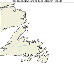
Fogo Island, Newfoundland and Labrador
| Map |
Img |
 |
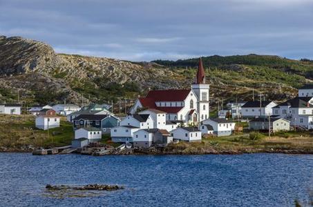 |
- Geographical Location: Off the northeast coast of Newfoundland, Canada.
- Purpose: Fogo Island combines traditional and modern aspects of Newfoundland culture and economics.
- Special Features:
- Known for its distinctive artist residencies and avant-garde architecture.
- A strong community focused on preserving cultural heritage while embracing sustainable development.
- Summary: Fogo Island represents a unique blend of contemporary art and traditional Newfoundland culture, making it a compelling destination for cultural tourism and community-driven economic revival.
Note from son:
Fogo Island is a place where the old fishing lifestyle once thrived but was nearly lost to industrial changes. Despite this, the island is known for its warm hospitality, embracing the “love of strangers” and making visitors feel welcome in its unique, beautiful setting.
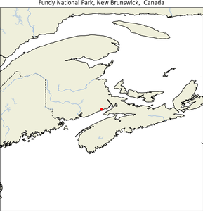
Fundy National Park, New Brunswick
| Map |
Img |
 |
 |
- Geographical Location: Located on the Bay of Fundy, near the village of Alma, New Brunswick, Canada.
- Establishment Date: Officially opened on July 29, 1950.
- Purpose: Preserves the Acadian Highlands, the coastal Bay of Fundy ecosystem, and its cultural heritage.
- Special Features:
- Home to the world’s highest tides.
- Features more than 25 waterfalls and a variety of sea life visible during low tide.
- Summary: Fundy National Park showcases the natural wonders of the Bay of Fundy, from its dramatic coastal cliffs and deep forests to the unique phenomenon of high tidal ranges, offering visitors both recreational opportunities and a chance to observe unique ecological phenomena.
Note from son:
Fundy National Park in New Brunswick is a beautiful spot for hiking, with trails that offer views similar to a smaller Grand Canyon. It features stunning waterfalls surrounded by lush trees and a peaceful beach, making it a perfect place for nature lovers.
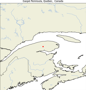
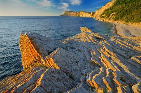
Gaspé Peninsula, Quebec
| Map |
Img |
 |
 |
- Geographical Location: Extends into the Gulf of St. Lawrence from Quebec, Canada.
- Establishment Date: Known since the time of European exploration for its distinct geography.
- Purpose: The peninsula is a key area for conservation, tourism, and cultural preservation.
- Special Features:
- Known for its rugged cliffs and maritime landscapes.
- Historically significant as a landing site of Jacques Cartier and a critical area during the Battle of the St. Lawrence in WWII.
- Summary: The Gaspé Peninsula, with its stunning natural beauty and rich history, offers a unique blend of outdoor adventures and historical sites, including several national parks and the famous Percé Rock.
Note from son:
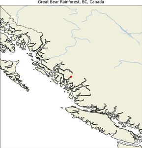
Great Bear Rainforest, British Columbia
| Map |
Img |
 |
 |
- Geographical Location: Pacific coast of British Columbia, Canada.
- Establishment Date: Legally established in February 2016.
- Purpose: To protect one of the world’s largest temperate rainforests and its ecosystem.
- Special Features:
- Encompasses 6.4 million hectares of protected land.
- Home to the rare white Kermode (“Spirit”) bear.
- Summary: The Great Bear Rainforest is a globally recognized conservation area known for its vast biodiversity, including a significant population of grizzly bears, wolves, and cougars, alongside the unique Spirit bear.
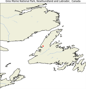
Gros Morne National Park, Newfoundland and Labrador
| Map |
Img |
 |
 |
- Geographical Location: West coast of Newfoundland, Canada.
- Establishment Date: Became a national park on October 1, 2005.
- Purpose: Protects the natural and cultural heritage of the area, including its complex geology.
- Special Features:
- World Heritage site due to its illustration of the process of continental drift.
- Features the second highest peak in Newfoundland, Gros Morne Mountain.
- Summary: Gros Morne National Park is celebrated not only for its dramatic landscape and biodiversity but also for its geological importance, offering striking scenery and a wide range of outdoor activities.
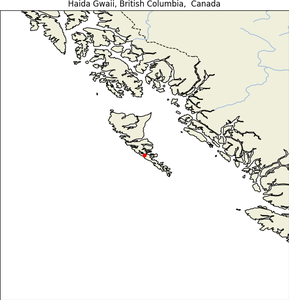
Haida Gwaii, British Columbia
| Map |
Img |
 |
 |
- Geographical Location: An archipelago off the northern Pacific coast of Canada.
- Establishment Date: Known historically, renamed on June 3, 2010, to reflect the Haida heritage.
- Purpose: To protect the cultural and natural heritage of the Haida people and their environment.
- Special Features:
- Known for its endemic species and significant cultural sites.
- Part of the area is protected under the Gwaii Haanas National Park Reserve and Haida Heritage Site.
- Summary: Haida Gwaii, often called Canada’s Galapagos, is a remote set of islands renowned for their ecological diversity and as the cultural heartland of the Haida Nation, reflecting a profound connection between the people and the land.
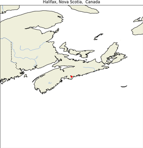
Halifax, Nova Scotia
| Map |
Img |
 |
 |
- Geographical Location: Capital of Nova Scotia, Canada.
- Establishment Date: Founded in 1749.
- Purpose: Acts as the major economic and cultural center of the eastern Maritime provinces.
- Special Features:
- Home to the Citadel National Historic Site, a key naval station during both World Wars.
- Rich maritime history displayed through its numerous museums and the waterfront.
- Summary: Halifax is a vibrant port city known for its maritime history, diverse culture, and as a key gateway to exploring Atlantic Canada, providing a dynamic mix of old-world charm and modern energy.
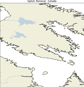
Iqaluit, Nunavut
| Map |
Img |
 |
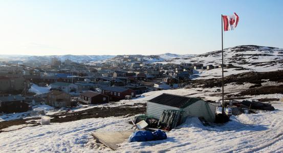 |
- Geographical Location: Capital of the Canadian territory of Nunavut, located on Baffin Island.
- Significant Date: Became the capital in 1999.
- Purpose: Serves as the administrative and cultural center of Nunavut.
- Special Features:
- Known for its Inuktitut culture and as a major northern Canadian hub.
- Experiences a polar climate with extreme variations in daylight.
- Summary: Iqaluit, formerly known as Frobisher Bay, is vital for its administrative role and its unique Arctic environment, providing essential services and a cultural gateway to eastern Arctic Canada.
Jasper National Park, Alberta
| Map |
Img |
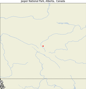 |
 |
- Geographical Location: Alberta’s Rocky Mountains, Canada.
- Establishment Date: Established as a national park in 1930.
- Purpose: To preserve the area’s natural beauty and biodiversity.
- Special Features:
- Contains part of the Columbia Icefield.
- Noted for its extensive network of trails, diverse wildlife, and hot springs.
- Summary:
Jasper National Park is a prime example of Alberta’s natural wealth, offering stunning alpine landscapes and a variety of wildlife, making it a top destination for nature lovers and adventure seekers alike.
Kluane National Park and Reserve, Yukon
| Map |
Img |
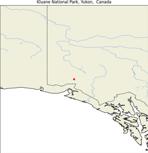 |
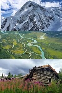 |
- Geographical Location: Southwest corner of the Yukon, Canada.
- Establishment Date: Established as a park reserve in 1972, became a national park in 1993.
- Purpose: To preserve natural landscapes and wildlife habitats, particularly high mountain ecosystem and large ice fields.
- Special Features:
- Home to Mount Logan, Canada’s highest peak.
- Contains extensive ice fields and is part of the Saint Elias Mountains.
- Summary: Kluane National Park and Reserve is recognized for its stunning rugged landscapes, significant glacial systems, and diverse fauna, including grizzly bears and Dall sheep. It is a key area for scientific research on glacial and ecological processes.
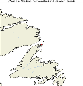
L’Anse aux Meadows, Newfoundland and Labrador
| Map |
Img |
 |
 |
- Geographical Location: Northern tip of Newfoundland, Canada.
- Significant Date: Archaeologically dated to around 1,000 years ago.
- Purpose: To protect and interpret the first known evidence of European presence in the Americas.
- Special Features:
- Site of a Norse village, evidence of the first European settlers in the New World.
- UNESCO World Heritage site.
- Summary: L’Anse aux Meadows is pivotal in understanding pre-Columbian European exploration and settlement, offering a glimpse into Viking expeditions and their life in North America well before other European arrivals.
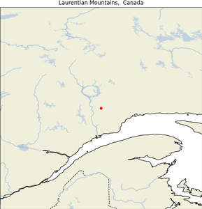
Laurentian Mountains, Quebec
| Map |
Img |
 |
 |
- Geographical Location: Extending through Quebec, Canada.
- Establishment Date: Known and inhabited for thousands of years; significant development during the 1800s.
- Purpose: A popular recreational area, providing a natural getaway for residents and visitors.
- Special Features:
- A major ski destination with numerous resorts.
- Offers a diverse range of outdoor activities year-round.
- Summary: The Laurentian Mountains are not just a natural barrier and climatic divide; they are a cultural and recreational heartland in Quebec, cherished for their beauty and the plethora of outdoor activities they offer.
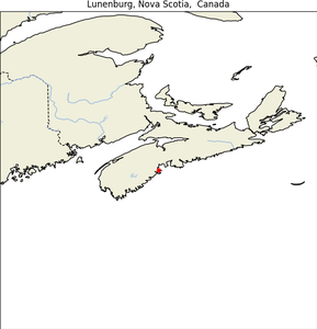
Lunenburg, Nova Scotia
| Map |
Img |
 |
 |
- Geographical Location: Located on the South Shore of Nova Scotia, Canada
- Established: 1753
- Purpose: Founded as a British colonial settlement for Protestant settlers from Germany, Switzerland, and France
- Special Features: Known for its well-preserved 18th-century architecture, UNESCO World Heritage Site, historic shipbuilding industry, and traditional marine culture
- Summary: Lunenburg is a historic town in Nova Scotia, known for its rich cultural heritage, stunning architecture, and maritime history. It is a popular tourist destination and a significant example of a British colonial settlement in North America.
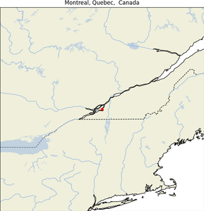
Montreal, Quebec ✅
| Map |
Img |
 |
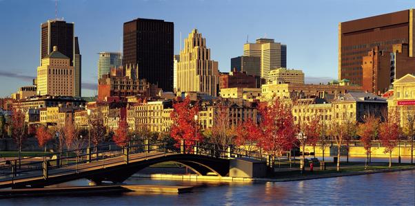 |
- Geographical Location: Province of Quebec, Canada.
- Establishment Date: Founded in 1642.
- Purpose: Acts as the cultural and economic center of Quebec.
- Special Features:
- Known for its vibrant arts scene, numerous festivals, and historic architecture.
- Home to several major universities and is a hub of aerospace, technology, and design industries.
- Summary: Montreal is celebrated for its diverse and rich cultural landscape, blending its French colonial history with a modern, dynamic North American character. The city is a leader in cultural trends and innovation in various sectors.
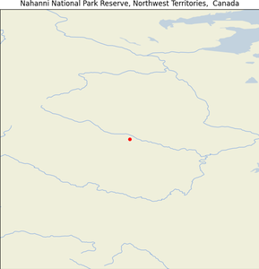
Nahanni National Park Reserve, Northwest Territories
| Map |
Img |
 |
 |
- Geographical Location: Dehcho Region of the Northwest Territories, Canada.
- Establishment Date: Inscribed as a UNESCO World Heritage Site in 1978.
- Purpose: To protect a portion of the Mackenzie Mountains Natural Region.
- Special Features:
- Features the South Nahanni River and Virginia Falls.
- Known for its deep river canyons, hot springs, and rich wildlife.
- Summary: Nahanni National Park Reserve is famed for its mysterious and wild beauty, offering one of the most pristine natural adventures in Canada. It is an iconic wilderness area known for its spectacular landscapes and geothermal activity.
###
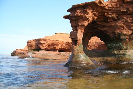
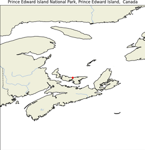
Prince Edward Island National Park, Prince Edward Island
| Map |
Img |
 |
 |
- Geographical Location: North shore of Prince Edward Island, Canada.
- Establishment Date: Established in 1937.
- Purpose: To protect coastal landscapes and ecosystems, including dunes and wetlands.
- Special Features:
- Includes Green Gables, part of the setting for “Anne of Green Gables.”
- Features red sandstone cliffs and extensive beach systems.
- Summary: Prince Edward Island National Park is a place of extraordinary natural beauty and cultural significance, offering a picturesque landscape that has inspired literature and attracted visitors seeking its serene beachfronts and unique ecosystems.
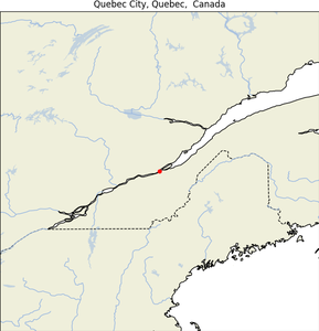
Quebec City, Quebec
| Map |
Img |
 |
 |
- Geographical Location: Capital of the province of Quebec, Canada.
- Establishment Date: Founded in 1608.
- Purpose: Serves as the administrative, cultural, and historical center of Quebec.
- Special Features:
- One of the oldest cities in North America featuring well-preserved colonial architecture.
- The only city in North America with its original city walls still intact.
- Home to the famous Château Frontenac and hosts the annual Winter Carnival.
- Summary: Quebec City stands as a living museum of New France history, adorned with its fortifications and old-world European charm. It’s a focal point of French Canadian culture, offering rich experiences from historical tours to vibrant festivals.
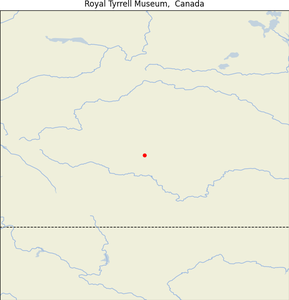
Royal Tyrrell Museum of Palaeontology, Alberta
| Map |
Img |
 |
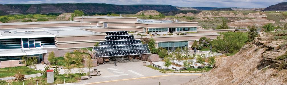 |
- Geographical Location: Drumheller, Alberta, Canada.
- Establishment Date: Opened in 1985.
- Purpose: To showcase and study the extensive dinosaur fossils found in the Drumheller Valley and surrounding areas.
- Special Features:
- Houses one of the world’s largest displays of dinosaurs.
- Offers interactive exhibits and educational programs focusing on Earth’s geological and paleontological history.
- Summary: The Royal Tyrrell Museum is a leading center for paleontological research and education, featuring dynamic displays of dinosaurs and fossil collections that attract scientists and tourists from around the globe.
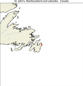
St. John’s, Newfoundland and Labrador
| Map |
Img |
 |
 |
- Geographical Location: Easternmost city in North America, Newfoundland and Labrador, Canada.
- Establishment Date: Legally became a city in 1921.
- Purpose: Acts as the economic, cultural, and administrative center of Newfoundland and Labrador.
- Special Features:
- Known for its vibrant painted houses and downtown murals.
- Rich maritime history and close ties to transatlantic shipping.
- Summary: St. John’s is characterized by its bright cityscape, historic sites like Signal Hill, its role in maritime history, and as a gateway to exploring the rugged beauty of Newfoundland.
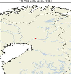
The Arctic Circle
| Map |
Img |
 |
 |
- Geographical Location: Encircles the globe at approximately 66°33′ North latitude.
- Purpose: Defines the boundary of the “Land of the Midnight Sun,” where the sun is visible at midnight near the summer solstice and does not rise near the winter solstice.
- Special Features:
- The region inside the Arctic Circle is characterized by arctic conditions, significant ice cover, and extreme variations in daylight.
- Summary: The Arctic Circle is not only a geographic boundary but also a climatic frontier, hosting unique ecosystems and cultures adapted to extreme conditions and offering unique phenomena like the Aurora Borealis.
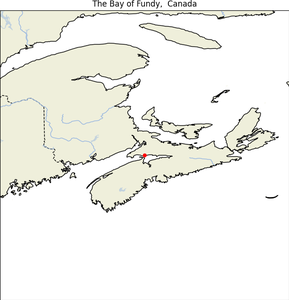
The Bay of Fundy, Nova Scotia/New Brunswick
| Map |
Img |
 |
 |
- Geographical Location: Between Nova Scotia and New Brunswick, Canada.
- Purpose: Known for having the highest tidal range in the world.
- Special Features:
- The tide can rise up to 16 meters (52 ft).
- Home to a variety of marine species and significant fossil discoveries.
- Summary: The Bay of Fundy is renowned for its spectacular tides, unique coastal rock formations, and its ecological diversity, making it a key site for both scientific research and tourism.
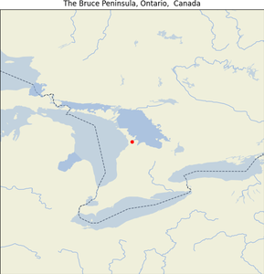
The Bruce Peninsula, Ontario ✅
| Map |
Img |
 |
 |
- Geographical Location: Ontario, Canada, between Georgian Bay and the main basin of Lake Huron.
- Purpose: Popular for outdoor recreation and contains part of the Niagara Escarpment.
- Special Features:
- Home to Bruce Peninsula National Park and Fathom Five National Marine Park.
- Features unique dolomite rock formations and diverse ecosystems.
- Summary: The Bruce Peninsula is celebrated for its rugged landscape and scenic beauty, offering numerous trails, diverse flora and fauna, and clear waters ideal for diving.
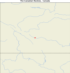
The Canadian Rockies, Alberta/British Columbia
| Map |
Img |
 |
 |
- Geographical Location: Stretch across British Columbia and Alberta, Canada.
- Purpose: To preserve the natural landscape and provide recreational activities.
- Special Features:
- Home to five national parks: Banff, Jasper, Kootenay, Yoho, and Waterton.
- Known for dramatic mountain peaks and extensive outdoor activities.
- Summary: The Canadian Rockies are not only a major mountain range offering breathtaking views and numerous recreational opportunities but also a critical habitat for a wide range of wildlife, making it a key destination for nature lovers worldwide.
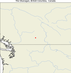
The Okanagan, British Columbia
| Map |
Img |
 |
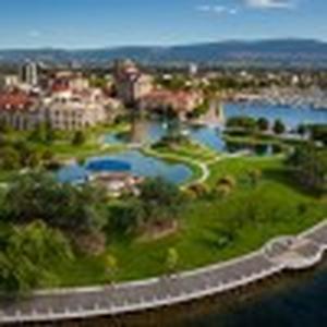 |
- Geographical Location: Southern British Columbia, Canada.
- Purpose: Famous for its wineries and fruit orchards, making it a key part of Canada’s wine industry.
- Special Features:
- Home to Okanagan Lake and numerous beaches and resorts.
- Hosts several cultural events and festivals, including wine festivals.
- Summary: The Okanagan is a vibrant agricultural and recreational hub known for its dry, sunny climate, scenic landscapes, and as a prolific wine-producing region, attracting both tourists and connoisseurs alike.
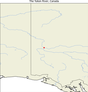
The Yukon River
| Map |
Img |
 |
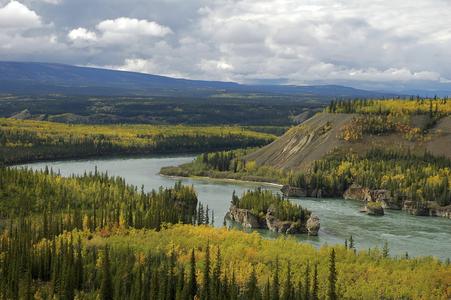 |
- Geographical Location: Flows from British Columbia, through the Yukon Territory and Alaska, USA.
- Purpose: Historically significant as a transportation route during the Klondike Gold Rush.
- Special Features:
- One of the longest rivers in North America at 3,190 kilometers (1,980 miles).
- Known for its salmon runs and wildlife along its banks.
- Summary: The Yukon River is not only a geographical landmark but also a cultural icon, reflecting the historical human endeavors in the region and serving as a critical natural habitat for various species.
Thousand Islands National Park
| Map |
Img |
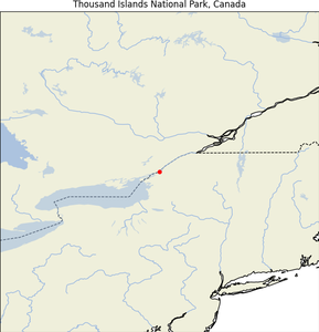 |
 |
- Geographical Location: Saint Lawrence River, along the border of Ontario, Canada, and New York, USA.
- Establishment Date: Established in 1904 as Canada’s first national park east of the Rockies.
- Purpose: To protect the unique ecological and cultural features of the Thousand Islands region.
- Special Features:
- Comprises over 20 islands and several mainland properties.
- Known for its rich biodiversity and recreational boating.
- Summary: Thousand Islands National Park is a key conservation area, offering a mosaic of unique ecosystems and historic sites, alongside popular recreational activities like boating and fishing in a scenic river setting.
Tofino, British Columbia
| Map |
Img |
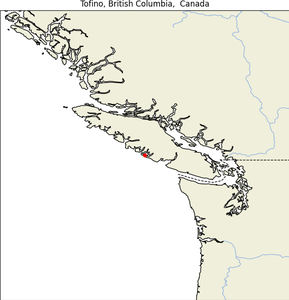 |
 |
- Geographical Location: West coast of Vancouver Island, British Columbia, Canada.
- Purpose: Popular for surfing, nature walks, and storm watching.
- Special Features:
- Located in the Clayoquot Sound Biosphere Reserve.
- Features long sandy beaches and a temperate rainforest.
- Summary: Tofino is renowned for its rugged coastline and natural beauty, attracting outdoor enthusiasts with its extensive opportunities for surfing, hiking, and cultural experiences with the local First Nations communities.
Vancouver, British Columbia
| Map |
Img |
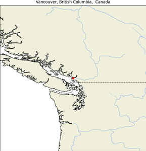 |
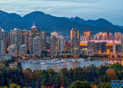 |
- Geographical Location: Lower Mainland region of British Columbia, Canada.
- Establishment Date: Incorporated in 1886.
- Purpose: Major urban center known for its port activities and as a hub for arts and culture.
- Special Features:
- Renowned for its environmental beauty and as a location for numerous film and TV productions.
- Features Stanley Park, one of the largest urban parks in North America.
- Summary: Vancouver stands out for its scenic views and mild climate, making it one of the most desirable living locations in Canada, celebrated for its cultural diversity and outdoor lifestyle.
Victoria, British Columbia
| Map |
Img |
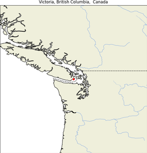 |
 |
- Geographical Location: Southern tip of Vancouver Island, British Columbia, Canada.
- Establishment Date: Incorporated as a city in 1862.
- Purpose: Serves as the capital of British Columbia.
- Special Features:
- Known for its historic architecture and the Butchart Gardens.
- Has a vibrant cultural scene with a focus on the arts, community, and sustainability.
- Summary: Victoria is a picturesque city with a relaxed pace and a rich colonial history. It’s known for its charming marinas, heritage architecture, and as a pioneering city in eco-tourism and green policy initiatives.
Waterton Lakes National Park, Alberta
| Map |
Img |
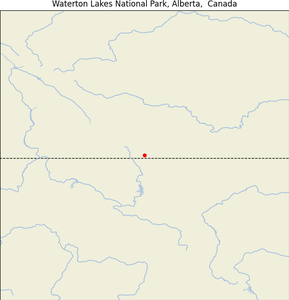 |
 |
- Geographical Location: Southwest corner of Alberta, Canada, bordering Montana’s Glacier National Park.
- Establishment Date: Established in 1895.
- Purpose: To protect unique wilderness habitats and facilitate cross-border conservation with Glacier National Park (USA).
- Special Features:
- Noted for its spectacular scenery and as a component of the Waterton-Glacier International Peace Park.
- Features diverse flora and fauna, including large carnivores like bears and cougars.
- Summary: Waterton Lakes National Park is not only a place of profound natural beauty but also a monument to peace and cooperation between nations, offering visitors breathtaking landscapes and a wide variety of outdoor recreational activities.
Whistler, British Columbia
| Map |
Img |
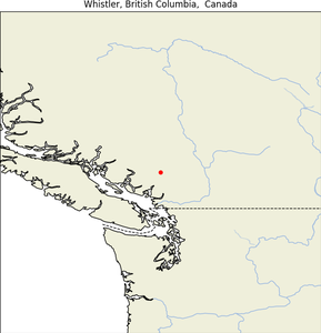 |
 |
- Geographical Location: In the Southern Pacific Ranges of the Coast Mountains in British Columbia, Canada.
- Purpose: Known for being one of the largest ski resorts in North America.
- Special Features:
- Hosted many events during the 2010 Winter Olympics.
- Features two majestic mountains, Whistler and Blackcomb, which provide year-round outdoor activities including skiing, mountain biking, and hiking.
- Summary: Whistler is a world-renowned ski destination and a vibrant village that offers various recreational and cultural activities, making it an ultimate resort town for all seasons.
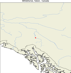
Whitehorse, Yukon
| Map |
Img |
 |
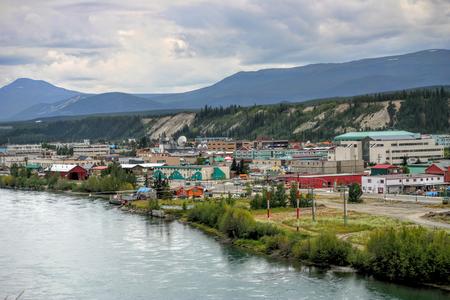 |
- Geographical Location: Along the Alaska Highway, as the capital and largest city of the Yukon, Canada.
- Purpose: Serves as the administrative and commercial hub of the Yukon.
- Special Features:
- Known for the SS Klondike National Historic Site and the nearby Takhini Hot Springs.
- Offers access to several outdoor activities, including the Yukon Quest dog sled race.
- Summary: Whitehorse is a gateway to the Yukon’s wilderness, providing a blend of cultural heritage and nature experiences, renowned for its friendly community and the stunning beauty of the surrounding landscapes.
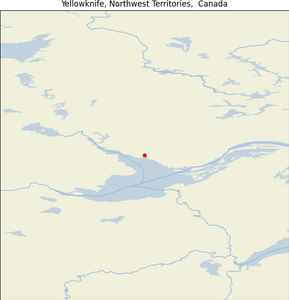
Yellowknife, Northwest Territories
| Map |
Img |
 |
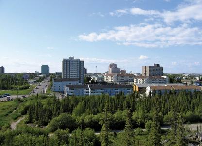 |
- Geographical Location: On the northern shore of Great Slave Lake, capital of the Northwest Territories, Canada.
- Establishment Date: Became the capital in 1967.
- Purpose: Acts as the economic and government center for the Northwest Territories.
- Special Features:
- The city is known for its diamond mines, the spectacular Aurora Borealis, and the vibrant indigenous culture.
- Features a unique northern environment with activities such as ice fishing and dog sledding.
- Summary: Yellowknife is a dynamic small city with a strong sense of community, set in a remarkable northern landscape that offers a unique lifestyle and direct access to an unspoiled wilderness.